United States

Romoland

Romoland

Romoland is a small unincorporated community in the southwestern part of Riverside County, California. It is located about 70 miles southea…

Best for you if…

  • A 4–5 day trip
  • Outdoor activities travelers
  • Sightseeing travelers
  • Visiting in Summer
Recommended stay
3-5 days
Best time
Summer
Walkability
Moderate
Guide depth
Solid guide
More about this guide

Romoland is a strong pick for outdoor activities & sightseeing — plan about 3-5 days. Peak season: Summer.

Solid guide guide · about 4 min to read · depth score 66/100 (coverage of intro, tips, and mapped places)

Moderate density — A mix of walkable clusters with some longer hops. (≈5.1 km span)

6 Places to explore
3-5 Recommended days
Summer Best season
8 Nearby places

Find nearby destinations

When to go

High season: Summer

JAN
FEB
MAR
APR
MAY
JUN
JUL
AUG
SEP
OCT
NOV
DEC

Best months for lower-cost travel: January · February · March · November · December

Weather

Fall

20°C - 30°C

Spring

15°C - 25°C

Summer

25°C - 35°C

Winter

10°C - 20°C

How to get there

How to Reach Romoland, United States

Located in Southern California, Romoland is a small unincorporated community in Riverside County. Despite its small size, Romoland offers a peaceful and charming atmosphere, making it an ideal destination for a relaxing getaway or a quick visit. If you're wondering how to reach Romoland, here are a few options:

By Air:

The nearest major airport to Romoland is Ontario International Airport (ONT), which is approximately 52 miles away. From the airport, you can rent a car or take a taxi to reach Romoland. Another option is to fly into Los Angeles International Airport (LAX), which is about 80 miles away, and then drive or take public transportation to Romoland.

By Car:

Driving to Romoland is a convenient option, especially if you're coming from nearby cities. If you're traveling from Los Angeles, take the I-10 E and I-215 S freeways, and then exit at Ethanac Road. From San Diego, take the I-15 N and I-215 N freeways, and then exit at McCall Boulevard. Romoland is easily accessible via these routes, and there are several parking options available in the area.

By Public Transportation:

If you prefer public transportation, you can take a train or bus to reach Romoland. The closest train station is the Perris Station, which is served by the Metrolink's 91/Perris Valley Line. From there, you can either take a taxi or use a ridesharing service to reach Romoland. Additionally, there are several bus routes that connect Romoland to neighboring cities, providing an affordable and convenient travel option.

By Bike or Walking:

If you're a local resident or staying nearby, you can also consider biking or walking to Romoland. The community is well-connected with pedestrian and bike-friendly paths, allowing you to enjoy the scenic views while reaching your destination. Just make sure to plan your route in advance and follow all safety guidelines.

Regardless of the mode of transportation you choose, reaching Romoland is relatively straightforward. Once you arrive, you can explore the local attractions, such as the Menifee Valley Historical Museum or enjoy outdoor activities at nearby Lake Perris State Recreation Area. Romoland welcomes visitors with its warm hospitality and serene surroundings, making it a hidden gem in Southern California.

Getting to know Romoland

Romoland is a small unincorporated community in the southwestern part of Riverside County, California. It is located about 70 miles southeast of Los Angeles and 20 miles southwest of Riverside. The rural town covers an area of approximately 3 square miles and has a population of around 2,500 people.

The community is primarily made up of residential neighborhoods and small farms. It is known for its rural character and peaceful surroundings, with many residents enjoying the slower pace of life compared to nearby urban areas.

Historically, Romoland began as a railroad town in the late 1800s, with the establishment of a station on the California Southern Railroad. The town was named after a local landowner, Henry C. Romoland, who provided much of the land for the railroad right-of-way in exchange for the station being built on his property.

Today, Romoland is a tight-knit community with a strong sense of pride in its history and culture. Residents enjoy a variety of community events throughout the year, including an annual carnival, a chili cookoff, and a holiday parade.

Pre-trip checklist

Compiled from local tips, stay length, and season notes.

Local tips

  • Pack sunscreen and hats for protection from the sun
  • Carry insect repellent for outdoor activities
  • Stay hydrated and drink plenty of water
  • Check for local events and festivals during your visit

Places worth exploring

6 places mapped for this destination

0–1
1–3
3–8
8–20
20+

Walking loops

Evening strolls, half-days, and fuller day loops — clustered by proximity.

Suggested 3-day outline

Places ordered by proximity into day buckets. Add what you like to your trip.

Frequently asked questions

Answers compiled from stay length, season, and local tips for this guide.

How many days do you need in Romoland?

Most travelers spend about 3-5 days in Romoland, United States.

When is the best time to visit Romoland?

High season is typically Summer.

Which months are more budget-friendly in Romoland?

Travelers often find better value in January, February, March, November, December.

What kind of trip is Romoland good for?

Romoland suits Outdoor activities, Sightseeing, Hiking, Camping.

Is Romoland walkable?

A mix of walkable clusters with some longer hops.

Any local tips for Romoland?

Pack sunscreen and hats for protection from the sun

Build your trip

Add Romoland and the places you want to see — your itinerary stays on this device.

Multi-city ideas

Nearby combinations sharing travel styles. See all routes

  • Romoland → Perris → Mead Valley · ≈14 km
  • Romoland → Nuevo → San Jacinto · ≈17 km
  • Romoland → Perris → March Air Force Base · ≈18 km

Same vibe

Destinations sharing travel styles, stay length, or region.

Explore nearby

Nearby places worth adding to your trip

Nuevo

United States

4.2 km · Best: Summer · 7-10 days · Spread

The Nuevo United States is a fictional place set in a dystopian future. It is a post-apocalyptic nation that has emerged after a catastroph…

Homeland

United States

4.6 km · Best: Summer · 7 days · Moderate

Homeland, the critically acclaimed television show, has earned a significant place in the United States' cultural landscape.

Perris

United States

6.8 km · Best: Spring and Fall · 3-5 days days · Moderate

Perris is a city located in Riverside County, California, United States. It is situated in the southern part of the state, about 71 miles e…

Menifee, CA

United States

8.7 km · Best: Summer · 5 days · Moderate

Menifee is a city located in southwestern Riverside County, California, United States. With a population of over 95,000 people, Menifee is…

Canyon Lake

United States

13 km · Best: Summer · 3-5 days · Spread

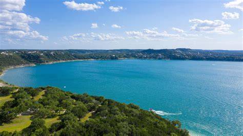
Located in the heart of the United States, Canyon Lake stands as a mesmerizing testament to the beauty of nature. Nestled within rolling hi…

Mead Valley

United States

14 km · Best: Summer · 3-5 days · Moderate

Mead Valley is a small community located within Riverside County in the United States. Situated in Southern California, Mead Valley is know…

San Jacinto

United States

16 km · Best: Spring · 3-5 days · Moderate

San Jacinto is a city located in Riverside County, California, United States. It is situated in the San Jacinto Valley, which is a part of…

Hemet

United States

16 km · Best: Spring and Fall · 5-7 days days · Moderate

Hemet is a city located in Riverside County, California, United States. It is situated in the San Jacinto Valley, which is known for its st…